Minneapolis Traffic Guide: Best Times, Routes & Tips
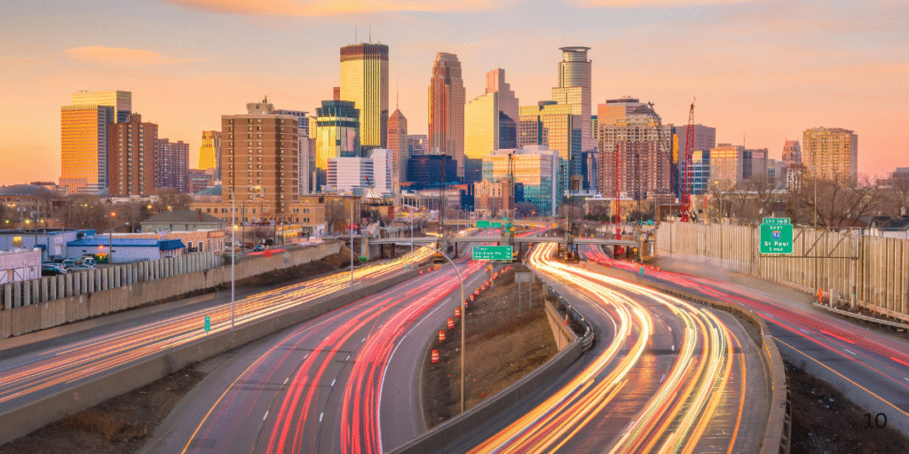
Minneapolis is a growing metropolitan hub where daily commuting, interstate travel, and airport transfers converge on a limited network of highways. Congestion here is shaped by recurring rush hours, seasonal construction, and winter weather. Understanding how traffic behaves in the Twin Cities helps travelers, business executives, and visitors plan with confidence.
We design itineraries around these traffic realities. Our chauffeurs use live data, toll-lane access, and MnDOT alerts to keep trips punctual. This guide explains when traffic is at its worst, which routes consistently clog, how Minnesota’s E-ZPass express lanes function, and what to know about MSP airport access.
Minneapolis Traffic at a Glance
On a typical weekday, rush hour traffic builds between 7:30–9:30 a.m. and again from 4:00–6:30 p.m.. Evening congestion usually lasts longer than the morning peak, with extended backups around the downtown exits and the river bridges.
Data from INRIX and TomTom confirm that Twin Cities drivers lose dozens of hours each year to congestion, with average travel speeds dropping by nearly 40% during peak windows. While volumes are lower than in New York or Chicago, the region’s reliance on a handful of corridors—particularly I-94, I-35W, and I-394—means even small disruptions create ripple effects across the network.
Core Corridors and Bottlenecks
I-94
Interstate 94 is the central east–west artery connecting Minneapolis and St. Paul. The Lowry Hill Tunnel is notorious for delays, especially when merging traffic meets downtown commuters. Approaches to the State Capitol and U.S. Bank Stadium are also frequent choke points.
I-35W
Interstate 35W runs north–south and carries heavy commuter traffic. The split where I-35W merges with I-94 is one of the most congested interchanges in the metro. Drivers often face slowdowns regardless of direction, with zipper-merge etiquette being a common frustration for locals.
I-394
I-394 feeds downtown from the west. Reversible lanes and E-ZPass segments help, but construction projects and lane reductions during summer add unpredictable delays. Congestion near the downtown exits is routine during rush hours and after major sporting events.
Beltways: I-494 and I-694
The I-494/I-694 loop encircles the metro. These beltways are essential bypass routes but can still bottleneck near interchanges with I-35W and I-94. Travelers heading between suburbs or to the airport often rely on these corridors.
E-ZPass Express Lanes in Minnesota
The Twin Cities operate E-ZPass express lanes on parts of I-35W and I-394. These lanes are designed to maintain reliable speeds during peak hours.
- Hours of operation: Typically 6:00–10:00 a.m. and 3:00–7:00 p.m. on weekdays.
- Eligibility: Vehicles with two or more occupants, transit buses, and motorcycles use them free. Solo drivers may enter if they have an active E-ZPass MN transponder and pay the posted dynamic toll.
- Pricing: Rates vary based on congestion. Higher demand means higher tolls. Off-peak hours often open the lanes to all drivers without charge.
For time-sensitive trips—such as catching a flight or arriving for a meeting—using E-ZPass lanes can save 10–20 minutes, especially along I-35W south into downtown.
Minneapolis–Saint Paul International Airport (MSP)
MSP is one of the busiest airports in the Midwest and sits immediately south of Minneapolis. Road access flows through I-494, Highway 5, and MN-62, all of which are prone to congestion.
The airport operates two passenger terminals: Terminal 1 (Lindbergh) and Terminal 2 (Humphrey). Each has separate access roads, so choosing the correct entry point prevents time-consuming loops around airport property.
Pickups and drop-offs are strictly enforced. Leaving a vehicle unattended at the curb can result in citations. Airport police monitor traffic continuously, so drivers need to coordinate with passengers in real time, often using the numbered doors at Terminal 1 or the Purple Ramp access lane at Terminal 2.
Construction, Winter, and Event Traffic
Construction Season
From late spring through fall, MnDOT manages extensive road work across the metro. Lane closures and detours affect I-35W, I-94, and the beltways every year. MnDOT’s 511MN system provides live maps, camera feeds, and closure updates, making it the most reliable source for current conditions.
Winter Conditions
Snow and ice quickly transform travel times. 511MN also tracks snowplow locations and displays road condition alerts, helping drivers anticipate whether travel speeds will be reduced. During storms, average speeds on I-35W and I-94 can fall below 25 mph.
Event Overlays
Large events at U.S. Bank Stadium, Target Center, Target Field, and Allianz Field regularly create traffic surges. Parking ramps near downtown fill quickly, and game-day traffic often pushes congestion well past normal rush hours. Travelers should plan buffers of 30–60 minutes when moving through downtown on event days.
Routing Strategies by Time of Day
- Morning (6:00–10:00 a.m.): Inbound congestion builds on I-35W south and I-94 east. E-ZPass express lanes offer value here. The Lowry Hill Tunnel is best avoided if timing is flexible.
- Mid-day (10:00 a.m.–3:00 p.m.): Traffic eases but incidents still cause sudden delays. Using MnDOT’s live cameras helps detect bottlenecks early.
- Evening (3:00–7:00 p.m.): The longest backups occur during this period. I-35W, I-94, and I-394 all slow significantly. E-ZPass tolls rise in response to demand.
- Weekends and Holidays: Traffic follows event schedules more than commuter patterns. Shopping districts and downtown entertainment areas cause concentrated congestion. Construction detours often remain in place through weekends.
Local Perspectives
Community forums often highlight the same pain points: merging into I-94 from I-35W, delays in the Lowry Hill Tunnel, and unpredictable backups on I-394. Residents often recommend leaving 30 minutes earlier than expected during peak hours. Others suggest timing departures an hour before or after the traditional rush to avoid the worst congestion.
Parking near downtown ramps is another challenge. Ramp A and Ramp B fill quickly during events, and drivers frequently report long exit times after games or concerts.
Tools for Real-Time Monitoring
Several resources provide accurate, up-to-date information on Minneapolis traffic:
- 511MN: Official MnDOT platform with closure maps, traffic cameras, and snowplow tracking.
- E-ZPass MN: Detailed schedules, lane maps, and transponder account management.
- Navigation apps with live data: Useful for rerouting around accidents or construction zones.
Using these tools before departure and en route is essential for staying on schedule.
How YAZ Luxury Transportation Makes Minneapolis Travel Predictable
For travelers, executives, and groups, managing Minneapolis traffic alone is stressful. YAZ Luxury Transportation Corp. manages every aspect of the journey so clients arrive on time, even when the roads are congested.
- Proactive scheduling: We calculate pickup times based on traffic forecasts, construction alerts, and E-ZPass lane availability.
- MSP airport expertise: Our chauffeurs know which terminal entry and which door minimize delays. We never leave passengers waiting at the wrong curb.
- Fleet flexibility: We provide luxury sedans and SUVs for executives, stretch limousines for special occasions, Sprinters for mid-sized groups, and mini buses or motor coaches for conferences and delegations. Every trip is matched with the right vehicle size.
- Adapting to weather and construction: When snow or closures disrupt main routes, we shift to beltway alternatives or surface streets to maintain reliable arrival times.
Our goal is to remove uncertainty from Minneapolis travel, so whether you are catching a flight, attending a meeting, or celebrating downtown, your transportation remains seamless.
Frequently Asked Questions
What time is rush hour in Minneapolis?
Rush hour is typically 7:30–9:30 a.m. and 4:00–6:30 p.m., with longer delays in the evening.
How do E-ZPass express lanes work?
They operate on I-35W and I-394 during peak hours. HOV-2+, buses, and motorcycles are free. Solo drivers need an E-ZPass transponder and pay a dynamic toll.
Which highways are most congested?
I-94 through downtown, the Lowry Hill Tunnel, I-35W near the I-94 merge, and I-394 westbound into downtown.
What’s the best way to pick up at MSP airport?
Coordinate at the correct terminal and door number. Unattended vehicles are ticketed, so drivers must stay in motion until passengers are ready.
Where can I check real-time traffic conditions?
511MN provides closures, cameras, and snowplow tracking. Navigation apps also show congestion in real time.
Conclusion
Minneapolis traffic is defined by predictable rush hours, construction detours, and winter weather. Understanding where bottlenecks form and how E-ZPass lanes operate allows travelers to reduce stress and stay on schedule.
With professional chauffeurs, a diverse fleet, and route planning that integrates MnDOT and E-ZPass data, YAZ Luxury Transportation Corp. keeps clients moving efficiently through the Twin Cities. Whether it’s an airport transfer, a corporate itinerary, or a special event downtown, we make travel in Minneapolis more reliable.